

VRPA Technologies, Inc.
Traffic Engineering | Civil Engineering | Transportation Planning |
Public Outreach | Environmental Assessments
Innovative Approach. Essential Expertise.
Founded in 1988, VRPA Technologies, Inc. offers comprehensive consulting services throughout the Western United States and specializes in traffic engineering, civil engineering, transportation planning, environmental assessments and public outreach and facilitation.
Over 2,500
Successfully Completed Projects

330+ Years
Of Combined Experience

2 Main Offices
4 Satellite Offices


Featured Projects

-
Central Valley Stations
The California High-Speed Rail Authority has initiated a project to provide design services for the Central Valley Stations (CVS) project comprised of the Merced, Fresno, Kings/Tulare and Bakersfield stations. The four stations and sites, as well as the associated planning activities, are being managed, designed, and documented as four separate design projects with stand-alone schematic design documents and with consistent design quality, common materials, detailing, and specification in line with the Authority’s Standards. VRPA’s project responsibilities have included the analysis of the traffic flow on the sites, calculating average daily traffic volumes anticipated from ridership projections and existing roadway capacity, and validating existing turning movement counts at the intersection within the study area and calculating future volumes based on projections. VRPA is also providing traffic engineering design for transportation facilities near the station areas.
Design Services for Merced to Madera (M2M)
The California High-Speed Rail (HSR) Authority (the Authority) is working to advance design and finalize the approximately 33.9-mile Merced to Madera project footprint. These critical steps will move the sections closer to construction, with the goal of electrified high-speed trains running between Merced and Bakersfield between 2030 and 2033. VRPA is serving as the utilities coordination lead for the M2M segment, managing Stantec’s team of utility design subconsultants and ensuring schedule adherence and proper coordination/review and input from the Authority. VRPA is responsible for monthly coordination meetings with impacted utility owners (Irrigation Districts, PG&E Electrical Distribution/Transmission/Gas, Kinder Morgan Petroleum, AT&T Communications, City of Merced Sewer) and other stakeholder agencies. VRPA performs key interdisciplinary coordination with track/roadway/environmental/structures/right-of-way/H&H/environmental team leads (in conjunction with Authority oversight) to ensure all utilities within this critical segment are relocated prior to the construction of the HSR corridor (track guideway, rail, and embankment).
Public Outreach for Design Services for Merced to Madera (M2M)
VRPA is providing public outreach services for the Design Services for Merced to Madera project. VRPA’s outreach responsibilities have included maintaining a stakeholder database, preparation of the Public Outreach and Communication Strategies document, and development of a property access training program. VRPA has also co-facilitated multi-county Farm Bureau and Water District status meetings, oversaw the distribution of the property owner noticing materials and the workshop noticing flyer, and participated in informational workshops in Merced, Chowchilla, and Fairmead.
Merced to Fresno On-Call Environmental Services
The California High-Speed Rail Authority’s Merced to Fresno On-Call Environmental Services contract includes as-needed environmental services, engineering services necessary to support the environmental work, and related specialized professional services necessary to provide environmental clearance. The work includes environmental analysis, CEQA/NEPA compliance and documentation, environmental re-examination/reevaluation, permitting, and environmental compliance during construction for the Merced to Fresno project section.
VRPA’s responsibilities under this contract were to conduct various transportation analyses. Examples include roadway closure analysis in Madera County, analysis of roadway design changes in within the City of Fresno, and traffic impact analysis for a proposed maintenance center.
Image Source: California High-Speed Rail Authority
-
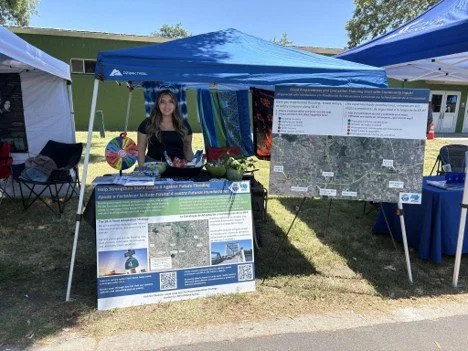
The San Joaquin Council of Governments (SJCOG), in partnership with Caltrans Districts 4 and 10, is overseeing the development of a Flood Adaptation Strategy (FAS) for State Route 4 (SR 4) through the San Joaquin Delta River. The FAS will assess the impacts of flood events of the San Joaquin River Delta on evacuation routing and will generate a list of priority flood-resilient capital improvement projects that SJCOG, in partnership with Caltrans Districts 4 and 10, could program on SR 4. The purpose of the FAS is to build on SJCOG’s 2022 Regional Resiliency Implementation Plan and Adaptation Guidance to develop a data-driven investment strategy for SR 4 as it experiences increasing flood risk. The FAS will improve and enhance the resiliency of the regional transportation network to a flood event by ensuring the network can more easily absorb, recover from, and adapt to flooding events. In addition to promoting climate and infrastructure resilience, the FAS will also address public safety, economic resilience, and cost-savings in the region with a focus on public benefits. VRPA is leading stakeholder and public engagement services for this project in coordination with WSP and SJCOG staff. VRPA is also assisting with existing conditions analysis, consequence analysis, adaptation strategy development and alternatives evaluation.
VRPA’s responsibilities on this project include:
Design a comprehensive Stakeholder and Public Engagement Plan tailored to those living and traveling through the project area.
Update, expand, and maintain the project’s Stakeholder database listing.
Assist with the development of meeting agendas, PowerPoint presentations, and related materials for Working Group meetings.
Coordinate with SJCOG website developers to establish a two-way communication portal on the SJCOG website so that the project team can actively solicit, gather and manage feedback from the public, and in turn, provide official, timely responses.
Develop and distribute community surveys (online and in-person) to broaden participation and coordinate with the preparation of the Draft and Final Plan.
Analyze survey results for use in the planning process.
Prepare bilingual (English/Spanish) engagement materials to ensure equitable access to project information.
Organize and participate in pop-up events to introduce the planning process and share information with the community's diverse members.
Organize and host virtual workshops to seek stakeholder and public input on the draft alternatives.
Prepare the Engagement Synopsis Report, which will provide a summary of all engagement activities and outcomes.
Summarize travel volume and other characteristics from Caltrans and local travel demand models, as well as local evacuation plans, for incorporation into the overall Existing Conditions memo.
Lead the site visit of the SR 4 study corridor, including preparation and safety planning, and documentation for incorporation into the overall Existing Conditions memo.
Summarize potential evacuation needs, alternative travel patterns, and resulting system impacts.
Lead the adaptation strategy development for civil engineering and traffic/ITS improvement.
Lead traffic analysis of alternatives evaluation.
Provide clear description of geographic locations of improvements and order-of-magnitude cost estimates for each alternative evaluation.
-
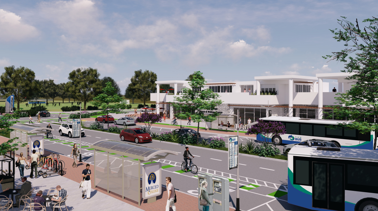
VRPA led the development of the Merced Regional Multimodal Access Plan (MRMAP). A major focus of the MRMAP was to identify transportation projects that facilitate multimodal access to and from the future integrated rail station in downtown Merced, recognizing passenger rail service as a critical component of the region’s mobility network that complements planned improvements to SR-99 and freight movement. At the time of the plan’s finalization, the California High-Speed Rail Authority had proposed relocating the Merced High-Speed Rail station to a site southeast of downtown Merced. The project team designed the multimodal transportation projects to remain highly relevant by providing essential connections to the existing Transpo Center in downtown Merced, which would serve as the primary hub linking local transit services to the future High-Speed Rail Station.
Based on the wide range of public input received and corresponding technical analysis, the MRMAP includes 18 projects, including an Express Bus route connecting UC Merced, Merced College, and Downtown Merced, four new microtransit zones, two new mobility hubs, and 11 active transportation projects that increase opportunities for non-car-dependent travel to access downtown Merced, Atwater, and Livingston. Collectively, the projects are calculated to result in capital costs of almost $40 million and reduce an estimated 677,000 vehicle miles traveled (VMT) per year–the equivalent of driving around the earth annually almost 27 times. The multimodal improvements will be incorporated into the next Merced County Association of Governments (MCAG) Regional Transportation Plan/Sustainable Communities Strategy.
The final Plan has been completed as is now available to the public: https://www.mcagov.org/DocumentCenter/View/5508/Final-MRMAP-Plan---02-11-26
Image Source: Citythinkers
-
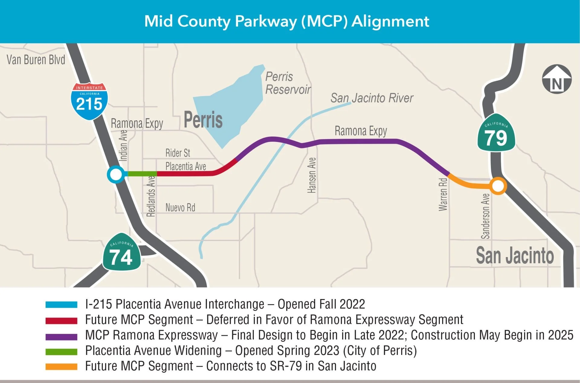
This multi-phase corridor analysis evaluated alternative alignments of a 32-mile east-west limited access route in western Riverside County to relieve congestion, improve safety and help address future traffic demands. Originally identified during the Riverside County Integrated Project (RCIP), the route was originally planned to connect the Corona and San Jacinto areas along the Cajalco-Ramona Expressway between the I-15 and SR 79. After detailed study and consideration a shorter, 16-mile improvement between San Jacinto and Perris was selected for implementation.
VRPA led the traffic analysis associated with the project, including the incorporation and update of local jurisdiction socioeconomic data and road networks for the travel demand modeling and traffic analysis for seven (7) alternatives. This effort included coordination between five (5) Cities and the County of Riverside. The Southern California Association of Governments 2030 Regional Traffic Model was utilized for the project. VRPA led efforts to compare and analyze the existing 2030 socioeconomic files against local City General Plans and new development projects surrounding the project area.
Image Source: Riverside County Transportation Commission

-
VRPA is leading the preparation of the Program Environmental Impact Report (PEIR) for the Madera County Transportation Commission. The PEIR will be developed in compliance with the California Environmental Quality Act (CEQA), and federal transportation and air quality requirements. The information presented in the PEIR will fully disclose potential impacts and increase public awareness and participation in the regional transportation planning process. VRPA's responsibilities will include collecting data, analyzing environmental impacts, assessing mitigation measures, and preparing the Draft and Final PEIR.
Image Source: Californiaherps.com
-
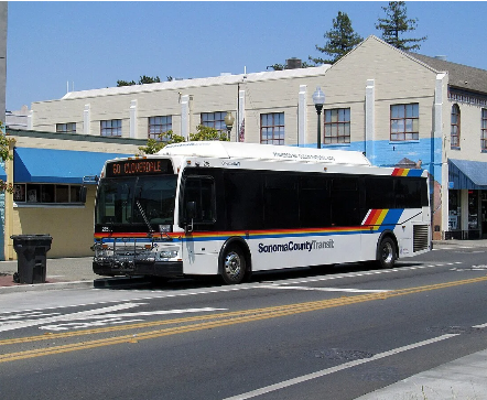
The purpose of the project is to prepare a five-year Strategic Transit Plan for transit services in the SCT service area boundary. This will be done in collaboration with staff from SCT, the Sonoma County Transportation and Climate Authorities (SCTCA), Santa Rosa City Bus, and Petaluma Transit. VRPA Technologies, Inc., in partnership with Via Mobility, LLC., will assess current transit conditions, facilitate stakeholder engagement, engage in collaborative regional transit planning, and develop an actionable strategic plan for pursuing transit improvements in the SCT service area and enhanced connections to the other transit systems in the region. VRPA is leading the development of this Plan with assistance from Via Mobility, LLC.
VRPA’s responsibilities as prime contractor for this project include:
Conducting a comprehensive assessment of current transit services and infrastructure.
Gathering input from key stakeholders, including community members, transit riders, governmental agencies, and partner organizations.
Conducting surveys and analyzing survey results.
Engaging in collaborative regional transit planning.
Developing recommendations for a five-year Strategic Transit Plan for Sonoma County Transit.
Presenting findings, including proposals for phased implementation.
Image Source: County of Sonoma

Ready to get started?
We’ll walk you through every step of the process.